Re-projection
The shapes making up a map can come from a range of coordinate reference systems - each using different measurements to record locations on the earth.
In order to combine these data sets on screen automatic reprojection is used to transform information into the common coordinate reference system you have selected for your map.
Open your Canada map from the previous section.
Add some additional shape files to the map from your data directory.
- 10m_admin_1_states_provinces.shp
- 10m_geography_regions_points.shp
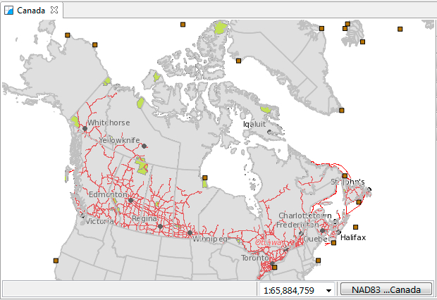
The resulting map is taking information from a variety of different sources and re-projecting the data into a single display.
You can ask that the map change its projection to match a layer.
Right click on 10m admin 1 states provinces and use Operation ‣ Set Map Projection from Layer to use this layers projection.
Not all coordinate reference systems can display all information. Some are only valid for a specific region.
This operation can be useful if you are having any trouble displaying a layer and want to directly view the data.
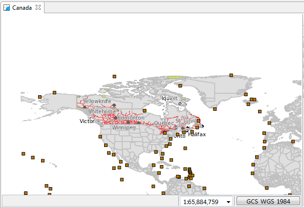
You can also choose the map coordinate reference system yourself.
In the Map editor status area pess the GCS_WGS_1984 button to bring up the Coordinate Systems property page for your map.
The Coordinate Systems property page allows you to change the Coordinate Reference System of your map. The Standard CRS tab allows you to search the predefined coordinate reference systems.
Please type in 4326 and press ENTER.
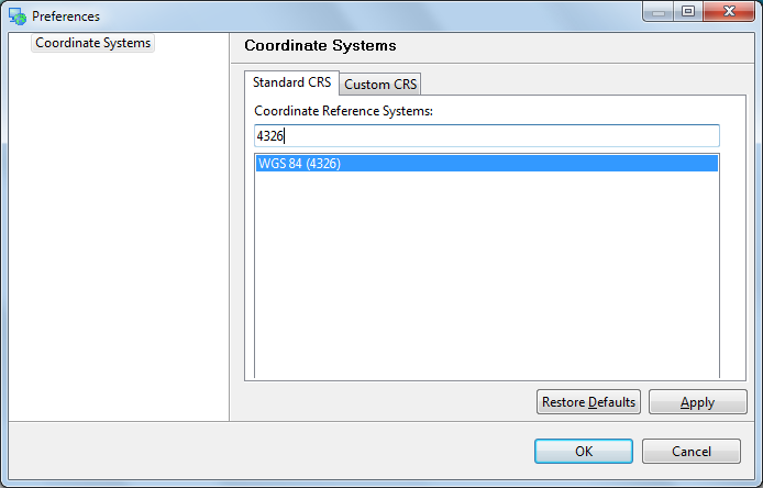
- This selects the World Geodetic System 1984 which is commonly used to represent lat/lon information.
- You can also search by name, try typing in WGS84 to list matching projections
You can have a look at the formal definition of EPSG:4326 by switching to the Custom CRS tab.
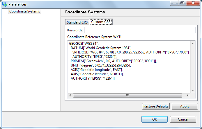
- The definition is provided in Well Known Text - you can use this format for your own custom CRS.
Press the OK button to change the coordinate reference system of your map.